The Local Geological Sites (LGS) classification provides a means of identifying and safeguarding some of the County’s best sites for geology. The intention is to complement nationally designated sites for geological conservation, helping to ensure the survival of important geological features.
Unlike Sites of Special Scientific Interest (SSSIs), a local site designation does not imply any legal or statutory duties and sites rely entirely upon sympathetic management by their owners for their conservation.
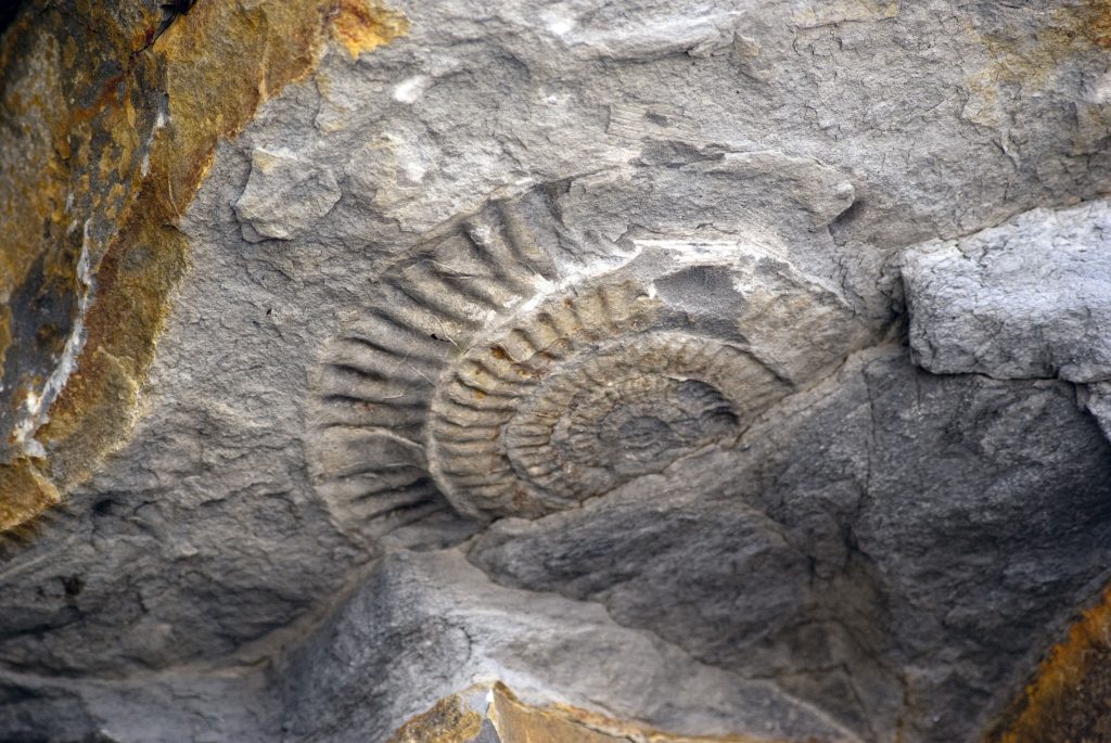
LGS (formerly known as Regionally Important Geological Sites or RIGS and sometimes as County Geological Sites) help preserve the county’s varied geological heritage. There are currently 220 in Somerset.
Designation
Designation is based on national guidelines (set out in the National Planning Policy Framework and associated guidance) with local considerations. It does not imply any right of public access and many LGS are on privately owned land. Somerset’s LGS (then RIGS) were mostly originally identified and adopted in local plans during the late 1980s and 1990s, with SERC working in partnership with the Somerset Geology Group (SGG).
Review (2016 – 2022)
SERC and SGG have worked in partnership in recent years to carry out a major review of Somerset’s LGS (including those for the Devon part of the Exmoor National Park), with their reconfirmation and any adjustment to their boundaries overseen by an LGS Panel. An improved evidence base is now held for each LGS, with details held by many more of their landowners. Additionally, five area reports were produced to summarise the overall conservation interest for that part of Somerset to which the individual LGS contribute (Somerset is one of the most geo-diverse counties in England).
Final report (covering year 5 of the project) May 2022
Somerset LGS Project – final report for Taunton area June 2023
Somerset LGS Project – Final report South Somerset Area June 2022
Somerset LGS Project – Final report for Mendips Area June 2022
Somerset LGS Project – Final report for Exmoor Area May 2021
Somerset LGS Project – Final report for Quantocks Area April 2020
Getting Information
Information relating to Local Geological Sites is held by SERC and can be accessed via the request data service. NB This is largely a fee-based service for potential developers and their agents. An initial area-search will indicate if a LGS or other environmental interest lies within the search area requested and if a LGS is involved, any more detailed information on it can then be requested – as any LGS designation will need to be considered if a planning application for development is being made.
If you own a Local Geological Site and would like to gain a greater understanding of the interest and/or discuss potential conservation management, please contact SERC direct and our team of SGG-sourced volunteers may be able to assist (the Exmoor National Park Authority may also be able to assist within Exmoor).
Bone fide geological enquirers, eg. for research and/or potential field study use, should also contact SERC direct (and SGG may also be able to assist).
Thanks – Our thanks to all those who have helped with the LGS Review including: graduate and SGG-sourced SERC volunteers; other SGG members; the Curry Fund of the Geologists’ Association; the Pat Hill-Cottingham Memorial Fund of Somerset Archaeological and Natural History Society; Exmoor National Park Authority; the Quantocks and Mendips National Landscapes; South Somerset District Council Community Fund; Wessex Water; Geckoella geological consultancy; the Mendip-based Somerset Earth Sciences Centre; Natural England and GeoConservationUK.